History of the city
Hannover – a city of change
From the "modern suburb" to a metropole in the Heart of Lower Saxony
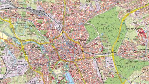
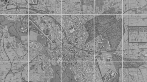
The city has a rich history from its medieval origins, through to its heyday as a royal residence, until the present day as the 21st century metropole Hanover City 2020+. Hanover is the capital of the state of Lower Saxony and is one of Germany’s major cities. The black and white map shows what the city looked like in 1916 and the coloured map on the right shows what it looks like now. The white button on the black and white map can be moved up and down with a click of the mouse so you can compare the changes in the cityscape over the years. At the end of the Second World War, the old town, Calenberger Neustadt and large areas of the neighbouring quarters of the city to the north, east and south lay in ruins. The reconstruction phase began. Urban planner Rudolf Hillebrecht ensured the city centre had wide streets and green open spaces. The Marktkirche (Market Church) was reconstructed in 1946 and is one of city’s most distinctive landmarks. During the 1950s, today’s government district was built on the area around Waterlooplatz. The Ihme-Zentrum was completed in 1975 in the Brutalist style. After the reunification of Germany, Hanover acquired a more central position in the country and the 2000 EXPO World Exhibition gave an important boost to the city’s development. The redevelopment of the area around the main train station is a prime example. Furthermore, the demolition of the Hochstrasse in 1999 significantly altered the appearance of Aegidientorplatz. The construction of the headquarters of the Nord/LB Bank at Friedrichswall also created an imposing landmark.
 © HMTG
 Stadtkarte Hannover heute
 © HMTG
 Stadtkarte Hannover 1914

 Deutsch
 English
 中文
中文
 Danish
 Eesti
Eesti
 Español
 Suomi
Suomi
 Français
 Italiano
 日本語
日本語
 한국
한국
 Nederlands
 Norge
Norge
 Polski
 Portugues
 Русский
 Svenska
 Türkçe
 العربية
 Romanesc
 български